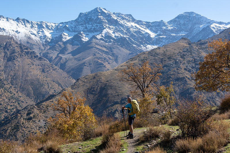
Vereda de la Estrella & Cortijos del Hornillos
Sierra Nevada
Grade: Challenging
Distance: 16 km
Ascent: 844 m
Time: 7 hrs
Optimal months: May to Nov incl
Map🗺️ - 3D⛰️ - Guide🔗 - Photos 📷
The Vereda de la Estrella is one of the most iconic hiking trails in the Sierra Nevada, offering breathtaking views of the region's highest peaks, including Mulhacén, Veleta, and Alcazaba.
An enriching extension to the Vereda de la Estrella is the route leading to the Cortijo del Hornillo, an old summer farmhouse nestled at an elevation of approximately 1,700 meters (5,577 feet). This site offers expansive vistas of the Sierra Nevada's prominent peaks and serves as a testament to the region's agricultural heritage.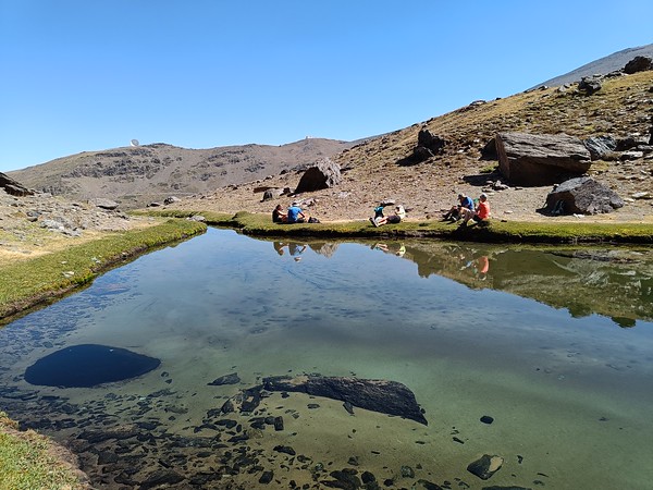
Laguna Misterioso and Molinillo Waterfall
Sierra Nevada
Grade: Moderate
Distance: 12 km
Ascent: 125 m
Time: 6 hrs
Optimal months: May to Nov incl
Map🗺️ - 3D⛰️ - Guide🔗 - Photos 📷
The trail leading to Lagunillo Misterioso begins at the Hoya de la Mora car park. Hikers traverse past the Virgen de las Nieves shrine, continue towards the Collado de las Yeguas, and pass by the Laguna de las Yeguas before reaching Lagunillos de la Virgen and ultimately Lagunillo Misterioso
By undertaking these hikes, you can experience the serene beauty of the Sierra Nevada, from the tranquil waters of Lagunillo Misterioso to the refreshing cascades of the Molinillo Waterfall.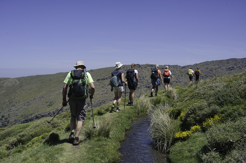
Acequia Los Hechos, Laguna del Puesta Cura
Sierra Nevada
Grade: Challenging
Distance: 11 km
Ascent: 590 m
Time: 7 hrs
Optimal months: May to Nov incl
Map🗺️ - 3D⛰️ - Guide🔗 - Photos 📷
The Acequia de Los Hechos, also known as the Acequia de la Alfaguara, is a historic irrigation channel that winds through the Sierra Nevada.
Walking alongside the acequia, you'll traverse lush forests and open landscapes, with views of prominent peaks like Los Alayos and El Trevenque. The gentle gradient makes it accessible for most fitness levels. Along the way, you'll encounter cascading waterfalls, diverse flora, and fauna, and remnants of historical structures, offering both natural beauty and cultural insights. The Laguna del Puesto del Cura, also known as Laguna del Cabrero, is a picturesque mountain lagoon nestled in the Sierra Nevada. It's a serene spot that reflects the surrounding peaks and offers a tranquil resting point for hikers.
Loop around the GR240 above Capileira
Sierra Nevada
Grade: Moderate
Distance: 12 km
Ascent: 546 m
Time: 5 hrs
Optimal months: Jan to Dec incl
Map🗺️ - 3D⛰️ - Guide🔗 - Photos 📷
The GR-240, also known as the Sulayr Trail, is a renowned long-distance footpath encircling the Sierra Nevada mountain range in Andalusia, Spain. Spanning approximately 300 kilometers, it's divided into 19 stages, offering hikers diverse terrains and breathtaking vistas. One of the notable segments of the GR-240 is the stretch between Capileira and Trevélez, two picturesque villages in the Alpujarras region
Lavaderos de la Reina
Sierra Nevada
Grade: Challenging
Distance: 18 km
Ascent: 700 m
Time: 7 hrs
Optimal months: May to Nov incl
Map🗺️ - 3D⛰️ - Guide🔗 - Photos 📷
The Lavaderos de la Reina hike is one of the most beautiful and iconic routes in the Sierra Nevada, located in the province of Granada, Andalusia. In spring, melting snow creates stunning cascades that feed into the lavaderos. Expect wildflowers, lush pastures, and panoramic views. On clear days, you’ll see Mulhacén, Veleta, and other 3,000m+ summits.
Tajos Campanario
Sierra Nevada
Grade: Moderate
Distance: 7 km
Ascent: 512 m
Time: 5 hrs
Optimal months: May to Nov incl
Map🗺️ - 3D⛰️ - Guide🔗 - Photos 📷
Embarking on a hike along the Tajos del Campanario ridge, situated north of Pico del Veleta in Spain's Sierra Nevada, offers adventurers a chance to experience rugged terrains and breathtaking vistas. This route is ideal for those seeking a moderately challenging trek with panoramic views of the surrounding landscapes.
Threading the Raspones
Sierra Nevada
Grade: Very Tough
Distance: 13 km
Ascent: 674 m
Time: 7 hrs
Optimal months: May to Nov incl
Map🗺️ - 3D⛰️ - Guide🔗 - Photos 📷
The Raspones de Río Seco are prominent peaks in Spain's Sierra Nevada mountain range, situated between the glacial basins of Río Seco and Veleta. This ridge features two main summits: the northern peak at 3,141 meters and the slightly lower southern peak at 3,137 meters, separated by a small breach which we pass through.
Refugio Cebollar
Sierra Nevada
Grade: Challenging
Distance: 15 km
Ascent: 926 m
Time: 7 hrs
Optimal months: May to Nov incl
Map🗺️ - 3D⛰️ - Guide🔗 - Photos 📷
Hiking to Refugio Cebollar from Puente Palo is a beautiful, moderately challenging route in the Alpujarras sector of the Sierra Nevada, offering forested trails, alpine meadows, and big views toward the Las Alegas ridge and the high peaks beyond.
Prado Llano and Refugio Poqueira
Sierra Nevada
Grade: Moderate
Distance: 17 km
Ascent: 758 m
Time: 6 hrs
Optimal months: May to Nov incl
Map🗺️ - 3D⛰️ - Guide🔗 - Photos 📷
Hiking from Hoya del Portillo to Prado Llano and Refugio Poqueira is a fantastic route that explores the high slopes of the Sierra Nevada, blending alpine forests, historic trails, glacial valleys, and stunning views toward Mulhacén and the Poqueira Gorge.
Northern Flanks of the Sierra Nevada
Sierra Nevada
Grade: Tough
Distance: 15 km
Ascent: 857 m
Time: 9 hrs
Optimal months: May to Nov incl
Map🗺️ - 3D⛰️ - Guide🔗 - Photos 📷
Embarking on a trek from Posiciones del Veleta through Corral del Veleta, Veta Grande, Laguna de la Gabata, and Pico de los Bolos, returning via the old road, offers a comprehensive exploration of the Sierra Nevada's diverse terrains.
Posiciones del Veleta: Offers panoramic views and serves as a historical site from the Spanish Civil War. Corral del Veleta: A glacial cirque beneath the Veleta peak, showcasing remnants of ancient glaciers. Veta Grande: A prominent ridge leading towards Cerro de los Machos, providing challenging terrains for seasoned hikers. Laguna de la Gabata: A high-altitude glacial lake offering serene landscapes and opportunities for rest. Pico de los Bolos: A notable summit providing expansive views of the surrounding ranges.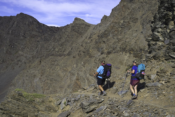
Vasar de Mulhacen
Sierra Nevada
Grade: Very Tough
Distance: 15 km
Ascent: 925 m
Time: 8 hrs
Optimal months: May to Nov incl
Map🗺️ - 3D⛰️ - Guide🔗 - Photos 📷
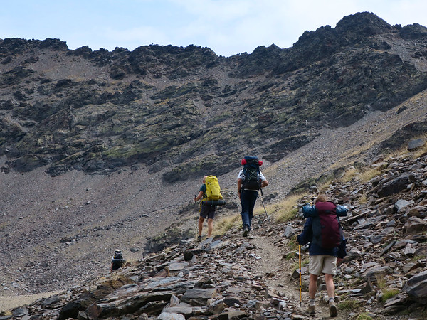
Hiking the Vasar de Mulhacén is one of the most spectacular and exposed high-mountain routes in the Sierra Nevada, traversing the dramatic north face of Mulhacén (3,479 m) — the highest peak in mainland Spain. This route is not a typical hike: it’s an aerial traverse along a narrow ledge halfway up a steep glacial cirque, offering breathtaking scenery and a dose of adrenaline.
Barranco del Cerezo and Hoya del Portillo
Sierra Nevada
Grade: Challenging
Distance: 14 km
Ascent: 564 m
Time: 6 hrs
Optimal months: Jan to Dec incl
Map🗺️ - 3D⛰️ - Guide🔗 - Photos 📷
The Barranco del Cerezo is a picturesque ravine located in the Sierra Nevada region, known for its natural beauty, diverse vegetation, and serene environment. Hiking in this area typically involves traversing narrow paths alongside streams, with opportunities to observe local flora and fauna
Hoya del Portillo serves as a common starting point for several high-altitude hikes in the Sierra Nevada, including routes leading to Mulhacén, the highest peak in mainland Spain. Located near the village of Capileira, it's accessible by vehicle up to a certain point, after which trails of varying difficulty levels are available.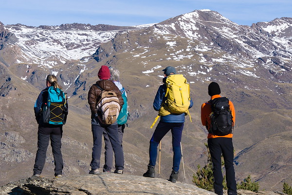
Barranco de Poqueira circular
Sierra Nevada
Grade: Challenging
Distance: 20 km
Ascent: 930 m
Time: 8 hrs
Optimal months: May to Nov incl
Map🗺️ - 3D⛰️ - Guide🔗 - Photos 📷
A must do circular offering a contrasting day walk from Capileira that provides a good introduction to the delights of the Sierra Nevada. Initially follows irrigation channels (acequias) on the eastern side of the gorge, returning high above on its western side before joining the river towards the end.
Around Mulhacén via the Vasar and Siete Lagunas
Sierra Nevada
Grade: Challenging
Distance: 12 km
Ascent: 900 m
Time: 7 hrs
Optimal months: May to Nov incl
Map🗺️ - 3D⛰️ - Guide🔗 - Photos 📷
This circular walk around Mulhacén takes an improbable looking horizontal shelf (Vasar de Mulhacén) across the seemingly vertical north face of Mulhacén to reach the peak of Puntal de Siete Lagunas. An adrenaline-filled but very straightforward walk to a superb summit with only one short section where the hands need to leave the pockets. A head for heights is advisable though.
It continues round into Siete Lagunas and returns to the refuge via the eastern traverse of Mulhacén. A relatively unknown route that visits some remarkable situartions on rarely visited paths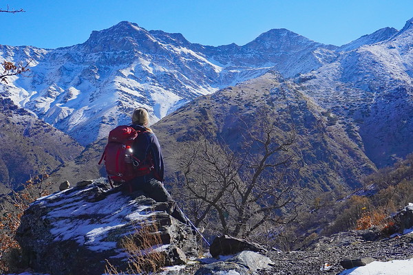
Cueva Secreta and Refugio Cucaracha
Sierra Nevada
Grade: Challenging
Distance: 19 km
Ascent: 1245 m
Time: 8 hrs
Optimal months: May to Nov incl
Map🗺️ - 3D⛰️ - Guide🔗 - Photos 📷
a circular hike that encompasses both Cueva Secreta and Refugio de la Cucaracha offers an immersive experience into the natural beauty and historical significance of the Sierra Nevada. This route combines lush river valleys, ancient mining paths, and serene mountain refuges, making it a favorite among seasoned hikers.
Walking along ancient mining routes and visiting traditional refuges provides a deep connection to the region's cultural and industrial past. The area is rich in biodiversity, with opportunities to observe native plant species and, occasionally, wildlife such as mountain goats and various bird species.